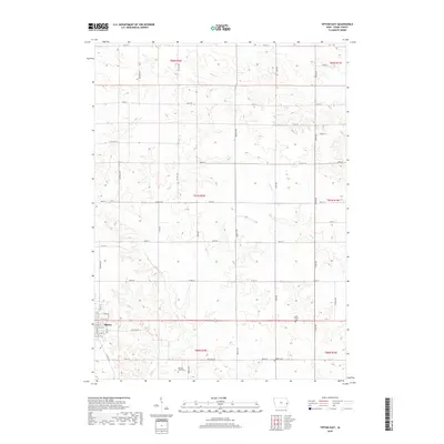
2018 Map of Tipton East
USGS Topo · Published 2018About this map
The eastern edges of Tipton and the surrounding Cedar County farmland are documented in this 2018 survey. The landscape is defined by the winding paths of Sugar Cr and Rock Cr, which carve through a grid of agricultural sections and county roads like Co Hwy F18 and Red Star Rd. For those researching local families, the map identifies three distinct burial sites: York Prairie Cem in the east, Virginia Grove Cem to the south, and Wright Cem near the southeastern corner. This modern survey illustrates the persistent rural structure of the region, where historical township lines like t81n r2w still dictate the organization of the land. The eastern residential streets of the county seat, including E 7th St and Park Rd, provide a detailed look at the town's expansion into the rolling Iowa countryside.
Find a feature on this map
45 named features on this map. Tap any name to fly to it.
Don’t see what you’re looking for? This feature index may not catch every label — zoom into the map to look around manually.
Map Details
Editions of this 2018 Tipton East Map
This is the sole edition of this map. No revisions or reprints were ever made.
Other maps of this area

1889 · Tipton
USGS Topo · 1:62,500

1890 · Durant
USGS Topo · 1:62,500

1890 · Tipton
USGS Topo · 1:62,500

1891 · Wilton Junction
USGS Topo · 1:62,500

1892 · Wheatland
USGS Topo · 1:62,500

1894 · Wheatland
USGS Topo · 1:62,500

1894 · Durant
USGS Topo · 1:62,500

1901 · Rock Island
USGS Topo · 1:125,000

1901 · Stanwood
USGS Topo · 1:125,000

1910 · Rock Island
USGS Topo · 1:125,000