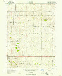
1953 Map of Tipton East
USGS Topo · Published 1958About this map
Tipton stands as the primary hub in this mid-century survey of Cedar County, where the agricultural grid is defined by a network of rural townships including Dayton, Fairfield, and Inland. The landscape is etched by the meandering paths of Sugar Creek and Rock Creek, which cut through the steady geometry of farm plots and section lines. A notable industrial transition is visible in the south, where a dismantled railroad runs parallel to the creek beds, signaling the shifting transportation priorities of the early 1950s.
Find a feature on this map
15 named features on this map. Tap any name to fly to it.
Don’t see what you’re looking for? This feature index may not catch every label — zoom into the map to look around manually.
Map Details
Editions of this 1953 Tipton East Map
This is the sole edition of this map. No revisions or reprints were ever made.
Other maps of this area

1889 · Tipton
USGS Topo · 1:62,500

1890 · Durant
USGS Topo · 1:62,500

1890 · Tipton
USGS Topo · 1:62,500

1891 · Wilton Junction
USGS Topo · 1:62,500

1892 · Wheatland
USGS Topo · 1:62,500

1894 · Wheatland
USGS Topo · 1:62,500

1894 · Durant
USGS Topo · 1:62,500

1901 · Rock Island
USGS Topo · 1:125,000

1901 · Stanwood
USGS Topo · 1:125,000

1910 · Rock Island
USGS Topo · 1:125,000