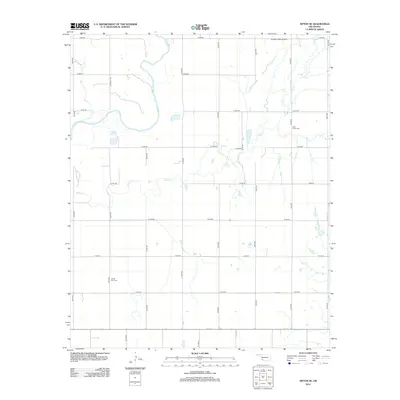
2012 Map of Tipton SE
USGS Topo · Published 2012About this map
The N Fork Red River winds through this rural section of Jackson County, carving a wide, sandy course across the landscape. The river's path and its tributaries, including the extensive Otter Cr and Deadman Cr, dictate the movement of the local road network. This grid of rural roads, such as e1650 RD and n2200 RD, serves a dispersed agricultural community and connects essential local landmarks. Genealogy and local history researchers will find the locations of Otter Creek Cem and Center View Cem significant for tracing family roots in the area. Aviation history is also represented by the Pleasant Valley Airport, situated in the northern portion of the quadrangle near the river's upper reaches.
Find a feature on this map
25 named features on this map. Tap any name to fly to it.
Don’t see what you’re looking for? This feature index may not catch every label — zoom into the map to look around manually.
Map Details
Editions of this 2012 Tipton SE Map
This is the sole edition of this map. No revisions or reprints were ever made.
Other maps of this area
1950 · Snyder
USGS Topo · 1:62,500
1955 · Lawton
USGS Topo · 1:250,000
1956 · Manitou
USGS Topo · 1:24,000
1956 · Snyder
USGS Topo · 1:24,000
1956 · Snyder
USGS Topo · 1:62,500
1958 · Frederick
USGS Topo · 1:62,500
1964 · Tipton SE
USGS Topo · 1:24,000
1964 · Tipton
USGS Topo · 1:24,000
1964 · Headrick
USGS Topo · 1:24,000
1964 · Long Mountain
USGS Topo · 1:24,000