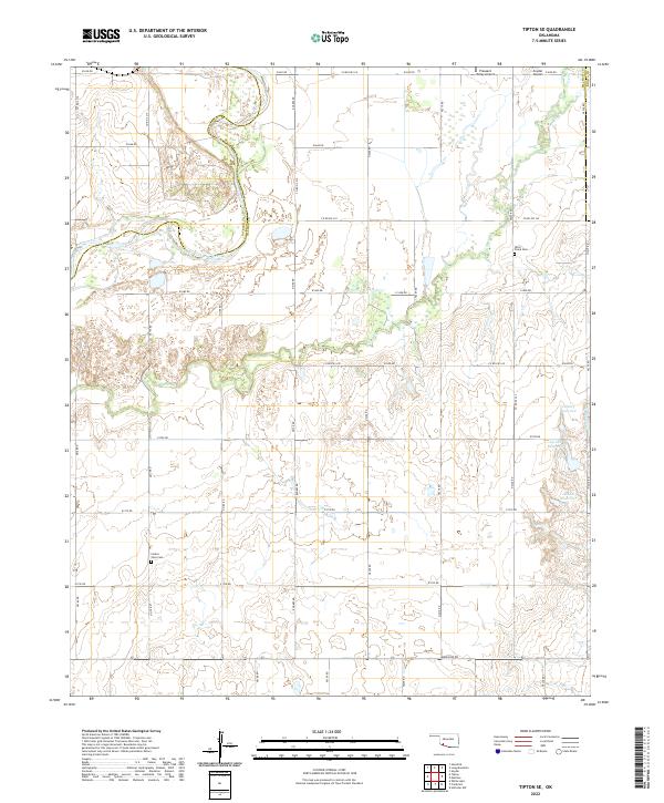
2022 Map of Tipton SE
USGS Topo · Published 2022About this map
The North Fork Red River forms a prominent natural boundary in the northwestern corner of this Tillman County landscape, where the shifting riverbed meets the administrative line of Jackson County. This section of Oklahoma is characterized by its agricultural grid, defined by a network of rural roads like Rogers Rd and Baseline Rd. The topography is marked by significant drainages, including Otter Cr and Deadman Cr, which feed into several numbered reservoirs such as 141003 Reservoir and 141002 Reservoir. Local history and genealogy interest is anchored by the Otter Creek Cem and Center View Cem, which remain as permanent landmarks in the rural countryside. Transportation in the region is supported by small aviation hubs, including Pleasant Valley Airport and Snyder Airport near the northern border.
Find a feature on this map
42 named features on this map. Tap any name to fly to it.
Don’t see what you’re looking for? This feature index may not catch every label — zoom into the map to look around manually.
Map Details
Editions of this 2022 Tipton SE Map
This is the sole edition of this map. No revisions or reprints were ever made.
Other maps of this area

1950 · Snyder
USGS Topo · 1:62,500

1955 · Lawton
USGS Topo · 1:250,000

1956 · Manitou
USGS Topo · 1:24,000

1956 · Snyder
USGS Topo · 1:24,000

1956 · Snyder
USGS Topo · 1:62,500

1958 · Frederick
USGS Topo · 1:62,500

1964 · Tipton SE
USGS Topo · 1:24,000

1964 · Tipton
USGS Topo · 1:24,000

1964 · Headrick
USGS Topo · 1:24,000

1964 · Long Mountain
USGS Topo · 1:24,000