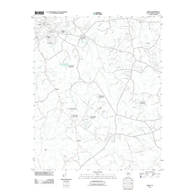
2011 Map of Tirzah
USGS Topo · Published 2011About this map
Rose Hill Cemetery and the York Post Office anchor the northwestern corner of this landscape, representing the established core of York as it transitioned into the twenty-first century. The surrounding area exhibits a mix of long-standing rural identity and modern residential growth, seen in neighborhoods like Musical Heights, Wooded Valley, and Forest Hills. This region of York County is defined by a dense network of tributaries including South Fork Fishing Creek, Stony Fork, and Tools Fork, which are intermittently punctuated by water control structures such as the South Carolina Noname 46026 D-3661 Dam. Smaller settlements like Guthries, Delphia, and Tirzah indicate the historic crossroads and rail-aligned communities that once facilitated local commerce throughout this Piedmont landscape.
Find a feature on this map
129 named features on this map. Tap any name to fly to it.
Don’t see what you’re looking for? This feature index may not catch every label — zoom into the map to look around manually.
Map Details
Editions of this 2011 Tirzah Map
This is the sole edition of this map. No revisions or reprints were ever made.
Other maps of this area

1906 · Kings Mountain
USGS Topo · 1:62,500

1907 · Sharon
USGS Topo · 1:62,500

1908 · Kings Mountain
USGS Topo · 1:62,500

1941 · Spartanburg
USGS Topo · 1:250,000

1947 · Clover
USGS Topo · 1:62,500

1949 · Clover
USGS Topo · 1:62,500

1949 · Rock Hill
USGS Topo · 1:62,500

1953 · Spartanburg
USGS Topo · 1:250,000

1953 · Charlotte
USGS Topo · 1:250,000

1954 · Charlotte
USGS Topo · 1:250,000