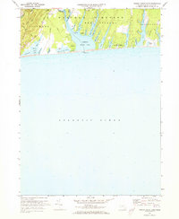
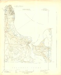
1972 Map of Tisbury Great Pond
USGS Topo · Published 1973About this map
Tisbury Great Pond dominates this southern reach of Martha's Vineyard, where the irregular coastline of West Tisbury and Chilmark meets the Atlantic Ocean. The landscape is defined by long, finger-like coves such as Deep Bottom Cove, Tiah Cove, and Tississa Cove, which reach inland from the central pond. These brackish waters are separated from the sea by a narrow barrier beach and a large Tidal Flat, illustrating the island's sensitive coastal morphology in the early 1970s.
Find a feature on this map
46 named features on this map. Tap any name to fly to it.
Don’t see what you’re looking for? This feature index may not catch every label — zoom into the map to look around manually.
Map Details
Editions of this 1972 Tisbury Great Pond Map
4 editions found
Other maps of this area

1887 · Gay Head
USGS Topo · 1:62,500

1887 · Marthas Vineyard
USGS Topo · 1:62,500

1889 · Gay Head
USGS Topo · 1:62,500

1889 · Marthas Vineyard
USGS Topo · 1:62,500

1893 · Gay Head
USGS Topo · 1:62,500

1894 · Marthas Vineyard
USGS Topo · 1:62,500

1942 · Marthas Vineyard
USGS Topo · 1:125,000

1944 · Tisbury Great Pond
USGS Topo · 1:31,680

1944 · Vineyard Haven
USGS Topo · 1:31,680
1944 · Edgartown
USGS Topo · 1:31,680