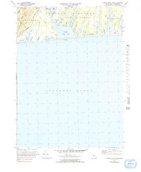
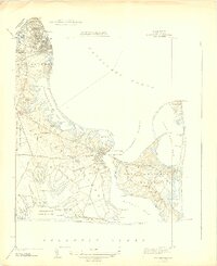
1972 Map of Tisbury Great Pond
USGS Topo · Published 1991About this map
The south shore of Marthas Vineyard is defined by a complex network of coastal ponds and fingers of water reaching inland during the early 1970s. The central feature, Tisbury Great Pond, is fed by the Tiasquam R and surrounded by a series of distinct coves including Deep Bottom Cove and Thumb Cove. This landscape illustrates the unique geological formation of the outwash plain, where narrow points like Plum Bush Pt and Scrubby Neck separate the brackish ponds from the Atlantic Ocean. Inland, the settlement pattern is sparse, concentrated around junctions such as Nabs Corner and the small cluster at Tississa. The map details the coastal topography across the town boundaries of Chilmark, West Tisbury, and Edgartown, showing a rural island character before significant modern development altered these traditional land divisions and road networks.
Find a feature on this map
49 named features on this map. Tap any name to fly to it.
Don’t see what you’re looking for? This feature index may not catch every label — zoom into the map to look around manually.
Map Details
Editions of this 1972 Tisbury Great Pond Map
4 editions found
Other maps of this area

1887 · Gay Head
USGS Topo · 1:62,500

1887 · Marthas Vineyard
USGS Topo · 1:62,500

1889 · Gay Head
USGS Topo · 1:62,500

1889 · Marthas Vineyard
USGS Topo · 1:62,500

1893 · Gay Head
USGS Topo · 1:62,500

1894 · Marthas Vineyard
USGS Topo · 1:62,500

1942 · Marthas Vineyard
USGS Topo · 1:125,000

1944 · Tisbury Great Pond
USGS Topo · 1:31,680

1944 · Vineyard Haven
USGS Topo · 1:31,680
1944 · Edgartown
USGS Topo · 1:31,680