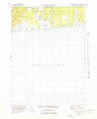
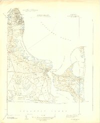
1972 Map of Tisbury Great Pond
USGS Topo · Published 1978About this map
The south shore of Marthas Vineyard is defined here by the intricate finger-like coves and coastal ponds of Chilmark, West Tisbury, and Edgartown. At the center of the sheet lies the expansive Tisbury Great Pond, fed by the Tiasquam R and the Middle Tiasquam River. The landscape transitions from the higher Ridge elevations in the west to the low-lying glacial outwash plain of Scrubby Neck. Small settlements and named corners like Quansoo and Nabs Corner are sparse, reflecting the rural and seasonal nature of the island in the early 1970s. Numerous narrow water bodies such as Deep Bottom Cove, Tiah Cove, and Pear Tree Cove reach northward from the sea, creating a highly fragmented shoreline that has historically influenced local travel and land use.
Find a feature on this map
37 named features on this map. Tap any name to fly to it.
Don’t see what you’re looking for? This feature index may not catch every label — zoom into the map to look around manually.
Map Details
Editions of this 1972 Tisbury Great Pond Map
4 editions found
Other maps of this area

1887 · Gay Head
USGS Topo · 1:62,500

1887 · Marthas Vineyard
USGS Topo · 1:62,500

1889 · Gay Head
USGS Topo · 1:62,500

1889 · Marthas Vineyard
USGS Topo · 1:62,500

1893 · Gay Head
USGS Topo · 1:62,500

1894 · Marthas Vineyard
USGS Topo · 1:62,500

1942 · Marthas Vineyard
USGS Topo · 1:125,000

1944 · Tisbury Great Pond
USGS Topo · 1:31,680

1944 · Vineyard Haven
USGS Topo · 1:31,680
1944 · Edgartown
USGS Topo · 1:31,680