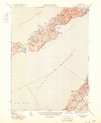
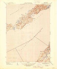
1944 Map of Naushon Island
USGS Topo · Published 1949About this map
The Elizabeth Islands chain is captured here at the end of the 1940s, showcasing the private and isolated character of Naushon Island and Pasque Island between Buzzards Bay and Vineyard Sound. A web of internal paths like Witches Glen Road and Bowdoin Road connects various coastal features, including the Tarpaulin Cove Lighthouse and the sheltered waters of Tarpaulin Cove.
Find a feature on this map
40 named features on this map. Tap any name to fly to it.
Don’t see what you’re looking for? This feature index may not catch every label — zoom into the map to look around manually.
Map Details
Editions of this 1944 Naushon Island Map
5 editions found
Other maps of this area

1885 · New Bedford
USGS Topo · 1:62,500

1886 · Falmouth
USGS Topo · 1:62,500

1887 · Gay Head
USGS Topo · 1:62,500

1888 · New Bedford
USGS Topo · 1:62,500

1888 · Falmouth
USGS Topo · 1:62,500

1889 · Gay Head
USGS Topo · 1:62,500

1893 · Gay Head
USGS Topo · 1:62,500

1893 · Falmouth
USGS Topo · 1:62,500

1893 · New Bedford
USGS Topo · 1:62,500

1915 · Falmouth
USGS Topo · 1:62,500