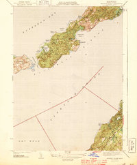
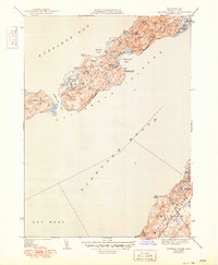
1944 Map of Naushon Island
USGS Topo · Published 1944About this map
The Elizabeth Islands chain is depicted in this 1941 survey, highlighting the distinct maritime geography of Naushon Island and Pasque Island between Buzzards Bay and Vineyard Sound. This wartime-era study documents a landscape largely defined by its natural topography and coastal features, with landmark elevations such as Mt Surat and Mt Cary rising above the wooded interiors of Ramshead Woods and Black Woods. Navigational safety is represented by the Tarpaulin Cove Lighthouse, which overlooks one of the few protected anchorages along the southern coast.
Find a feature on this map
28 named features on this map. Tap any name to fly to it.
Don’t see what you’re looking for? This feature index may not catch every label — zoom into the map to look around manually.
Map Details
Editions of this 1944 Naushon Island Map
5 editions found
Other maps of this area

1885 · New Bedford
USGS Topo · 1:62,500

1886 · Falmouth
USGS Topo · 1:62,500

1887 · Gay Head
USGS Topo · 1:62,500

1888 · New Bedford
USGS Topo · 1:62,500

1888 · Falmouth
USGS Topo · 1:62,500

1889 · Gay Head
USGS Topo · 1:62,500

1893 · Gay Head
USGS Topo · 1:62,500

1893 · Falmouth
USGS Topo · 1:62,500

1893 · New Bedford
USGS Topo · 1:62,500

1915 · Falmouth
USGS Topo · 1:62,500