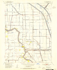
1952 Map of Tisdale Weir
USGS Topo · Published 1954About this map
The Sacramento River carves a winding path through this 1952 topographic study, marking the natural boundary between Sutter and Colusa counties. This landscape is defined by its complex water management systems, notably the Tisdale Weir and its associated Tisdale By-Pass, which channel floodwaters away from the fertile agricultural basins. Small landings and vanished transportation points like Fraziers Landing and the Eddys Ferry (Site) indicate the river's historical role as a primary corridor for movement before modern infrastructure dominated.
Find a feature on this map
33 named features on this map. Tap any name to fly to it.
Don’t see what you’re looking for? This feature index may not catch every label — zoom into the map to look around manually.
Map Details
Editions of this 1952 Tisdale Weir Map
3 editions found
Other maps of this area

1888 · Marysville
USGS Topo · 1:125,000

1891 · Marysville
USGS Topo · 1:125,000

1894 · Marysville
USGS Topo · 1:125,000

1895 · Marysville
USGS Topo · 1:125,000

1907 · Dunnigan
USGS Topo · 1:62,500

1910 · Marcuse
USGS Topo · 1:31,680

1911 · Sutter
USGS Topo · 1:31,680

1911 · Grimes
USGS Topo · 1:31,680

1911 · Gilsizer Slough
USGS Topo · 1:31,680

1912 · Marysville Buttes
USGS Topo · 1:31,680