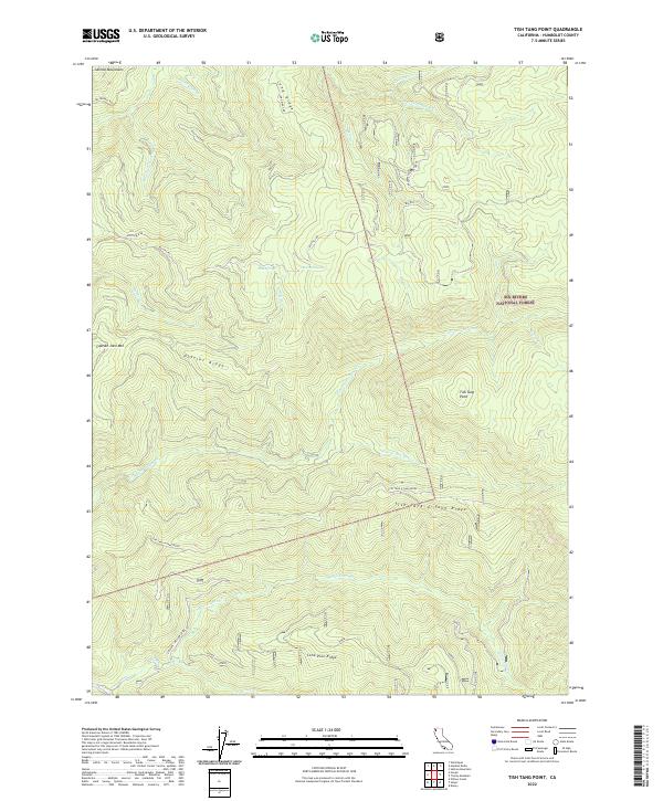
2022 Map of Tish Tang Point
USGS Topo · Published 2022About this map
Six Rivers National Forest encompasses the majority of this territory, characterized by high ridges and deep watercourses. The landscape is defined by the prominent Tish Tang a Tang Ridge and Hostler Ridge, which partition the drainage of several creek systems. The presence of Mud Springs and Bowman Spring suggests vital water sources in this elevated terrain, while named peaks like Captain John Mtn and Tish Tang Point provide significant landmarks for navigation within the forest. In the southwest, the Trinity Wild and Scenic River forms a protected corridor, reflecting a modern conservation landscape. This 2022 survey details the network of forest roads, including Big Hill Rd and Hostler B Rd, which follow the contours of the Salmon Mountains to connect remote ridgelines.
Find a feature on this map
32 named features on this map. Tap any name to fly to it.
Don’t see what you’re looking for? This feature index may not catch every label — zoom into the map to look around manually.
Map Details
Editions of this 2022 Tish Tang Point Map
This is the sole edition of this map. No revisions or reprints were ever made.
Other maps of this area

1909 · Big Bar
USGS Topo · 1:96,000

1915 · Big Bar and Vicinity
USGS Topo · 1:250,000

1922 · China Flat
USGS Topo · 1:62,500

1925 · Hoopa
USGS Topo · 1:125,000

1948 · Weed
USGS Topo · 1:250,000

1950 · Weed
USGS Topo · 1:250,000

1951 · Ironside Mountain
USGS Topo · 1:62,500

1952 · Willow Creek
USGS Topo · 1:62,500

1952 · Hoopa
USGS Topo · 1:62,500

1955 · Salmon Mtn
USGS Topo · 1:62,500