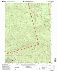
1997 Map of Tish Tang Point
USGS Topo · Published 2001About this map
The Hoopa Valley Indian Reservation dominates the western half of this terrain, where the rugged landscape is defined by the steep elevation changes of Hostler Ridge and the deep drainage of Tish Tang Creek. East of the reservation boundary, the land transitions into the Six Rivers National Forest, eventually reaching the protected high-country of the Trinity Alps Wilderness along the eastern margin.
Find a feature on this map
35 named features on this map. Tap any name to fly to it.
Don’t see what you’re looking for? This feature index may not catch every label — zoom into the map to look around manually.
Map Details
Editions of this 1997 Tish Tang Point Map
This is the sole edition of this map. No revisions or reprints were ever made.
Other maps of this area

1909 · Big Bar
USGS Topo · 1:96,000

1915 · Big Bar and Vicinity
USGS Topo · 1:250,000

1922 · China Flat
USGS Topo · 1:62,500

1925 · Hoopa
USGS Topo · 1:125,000

1948 · Weed
USGS Topo · 1:250,000

1950 · Weed
USGS Topo · 1:250,000

1951 · Ironside Mountain
USGS Topo · 1:62,500

1952 · Willow Creek
USGS Topo · 1:62,500

1952 · Hoopa
USGS Topo · 1:62,500

1955 · Salmon Mtn
USGS Topo · 1:62,500