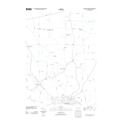
2013 Map of Titusville North
USGS Topo · Published 2013About this map
Titusville serves as the southern anchor for this map, where the street grid of the city meets the industrial legacy of the region. The area to the north is defined by a series of agricultural and industrial landmarks, including the Church Run Oil Field and the historically significant Thompsons Mills. The landscape is a network of ridges and runs, where Fink Ridge and Gilson Ridge rise above various waterways like Oil Creek and Church Run. Small settlements and road junctions such as McLaughlin Corners, Vrooman, and Shelmadine Springs dot the countryside, connected by rural routes like Magee Rd and Cloverdale Rd. This modern survey documents the persistent rural character and continued importance of resource extraction and local aviation, evidenced by the Paul Personal Use Airport situated near Dolly Run.
Find a feature on this map
73 named features on this map. Tap any name to fly to it.
Don’t see what you’re looking for? This feature index may not catch every label — zoom into the map to look around manually.
Map Details
Editions of this 2013 Titusville North Map
This is the sole edition of this map. No revisions or reprints were ever made.
Other maps of this area

1927 · Townville
USGS Topo · 1:48,000

1927 · Titusville
USGS Topo · 1:62,500

1929 · Corry
USGS Topo · 1:48,000

1929 · Union City
USGS Topo · 1:62,500

1932 · Corry
USGS Topo · 1:62,500

1932 · Townville
USGS Topo · 1:62,500

1932 · Union City
USGS Topo · 1:62,500

1933 · Titusville
USGS Topo · 1:62,500

1945 · Townville
USGS Topo · 1:62,500

1957 · Warren
USGS Topo · 1:250,000