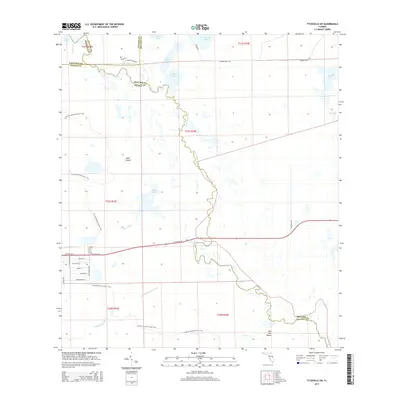
2015 Map of Titusville SW
USGS Topo · Published 2015About this map
The Saint Johns River defines the central spine of this landscape, meandering through a vast network of wetlands and lakes at the meeting point of Brevard, Orange, Seminole, and Volusia counties. This 2015 survey illustrates a primarily natural corridor dominated by hydrologic features like Puzzle Lake, Loughman Lake, and Lake Cone. The Florida National Scenic Trail winds through the western half of the quadrangle, crossing varied terrain near Tootoosahatchee Creek and the notable Bear Island.
Find a feature on this map
42 named features on this map. Tap any name to fly to it.
Don’t see what you’re looking for? This feature index may not catch every label — zoom into the map to look around manually.
Map Details
Editions of this 2015 Titusville SW Map
This is the sole edition of this map. No revisions or reprints were ever made.
Other maps of this area

1949 · Titusville
USGS Topo · 1:24,000

1949 · Mims
USGS Topo · 1:24,000

1949 · Sharpes
USGS Topo · 1:24,000

1950 · Aurantia
USGS Topo · 1:24,000

1951 · Sharpes
USGS Topo · 1:24,000

1952 · Mims
USGS Topo · 1:24,000

1952 · Titusville
USGS Topo · 1:24,000

1953 · Narcoossee NE
USGS Topo · 1:24,000

1953 · Geneva
USGS Topo · 1:24,000

1953 · Titusville SW
USGS Topo · 1:24,000