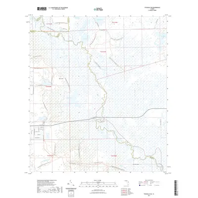
2021 Map of Titusville SW
USGS Topo · Published 2021About this map
The Saint Johns River defines this eastern Florida landscape, winding through a complex system of marshes and lakes where Brevard, Orange, Seminole, and Volusia counties meet. In the south, the Tootoosahatchee Cr flows through protected lands, including the Tosohatchee Wildlife Management Area Trl. This area is characterized by low-lying wetlands like Lorelei Swamp and distinctive terrain features such as Paw Paw Mound and Bear Island.
Find a feature on this map
47 named features on this map. Tap any name to fly to it.
Don’t see what you’re looking for? This feature index may not catch every label — zoom into the map to look around manually.
Map Details
Editions of this 2021 Titusville SW Map
This is the sole edition of this map. No revisions or reprints were ever made.
Other maps of this area

1949 · Titusville
USGS Topo · 1:24,000

1949 · Mims
USGS Topo · 1:24,000

1949 · Sharpes
USGS Topo · 1:24,000

1950 · Aurantia
USGS Topo · 1:24,000

1951 · Sharpes
USGS Topo · 1:24,000

1952 · Mims
USGS Topo · 1:24,000

1952 · Titusville
USGS Topo · 1:24,000

1953 · Narcoossee NE
USGS Topo · 1:24,000

1953 · Geneva
USGS Topo · 1:24,000

1953 · Titusville SW
USGS Topo · 1:24,000