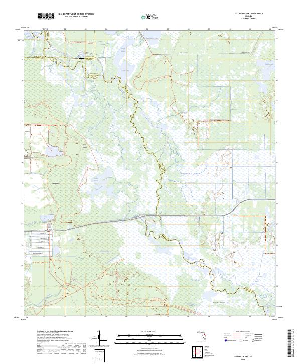
2024 Map of Titusville SW
USGS Topo · Published 2024About this map
The settlement of Christmas serves as a gateway to the intricate riverine and swamp landscapes where the boundaries of Orange, Brevard, Seminole, and Volusia counties converge. This modern survey illustrates a territory defined by conservation and water, dominated by the winding course of the Saint Johns River and its associated basins like Puzzle Lake and Loughman Lake. The transition from rural residential streets such as Antler St and Celestial St into the expansive Saint Johns National Wildlife Refuge and Lorelei Swamp highlights the region's focus on habitat preservation. Grounded landmarks like Bear Island and Paw Paw Mound offer topographic contrast to the low-lying wetlands. The area is crisscrossed by significant recreational corridors, including the Florida National Scenic Trl and the Tosohatchee Wildlife Management Area Trl, tracing the natural drainage patterns of Tootoosahatchee Creek.
Find a feature on this map
45 named features on this map. Tap any name to fly to it.
Don’t see what you’re looking for? This feature index may not catch every label — zoom into the map to look around manually.
Map Details
Editions of this 2024 Titusville SW Map
This is the sole edition of this map. No revisions or reprints were ever made.
Other maps of this area

1949 · Titusville
USGS Topo · 1:24,000

1949 · Mims
USGS Topo · 1:24,000

1949 · Sharpes
USGS Topo · 1:24,000

1950 · Aurantia
USGS Topo · 1:24,000

1951 · Sharpes
USGS Topo · 1:24,000

1952 · Mims
USGS Topo · 1:24,000

1952 · Titusville
USGS Topo · 1:24,000

1953 · Narcoossee NE
USGS Topo · 1:24,000

1953 · Geneva
USGS Topo · 1:24,000

1953 · Titusville SW
USGS Topo · 1:24,000