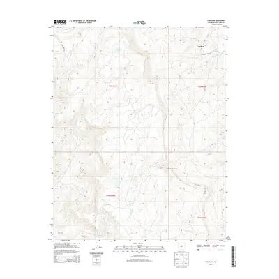
2013 Map of Toadlena
USGS Topo · Published 2013About this map
The Chuska Mountains dominate the western horizon of this high-desert landscape in the San Juan Basin. The settlement of Toadlena serves as a primary focal point, anchored by its local Po and proximity to Indian Service Route 191. The terrain is defined by a series of deep drainages and intermittent water sources that have shaped the local geography for generations, including the prominent Captain Tom Wash, Toadlena Lake, and the aptly named Big Water Spring.
Find a feature on this map
16 named features on this map. Tap any name to fly to it.
Don’t see what you’re looking for? This feature index may not catch every label — zoom into the map to look around manually.
Map Details
Editions of this 2013 Toadlena Map
This is the sole edition of this map. No revisions or reprints were ever made.
Other maps of this area

1889 · Chaco
USGS Topo · 1:250,000

1892 · Chaco
USGS Topo · 1:250,000

1892 · Canyon De Chelly
USGS Topo · 1:250,000

1953 · Sanostee
USGS Topo · 1:62,500

1954 · Shiprock
USGS Topo · 1:250,000

1955 · Sonsala Butte 4 SE
USGS Topo · 1:24,000

1955 · Sonsala Butte 1 SE
USGS Topo · 1:24,000
1955 · Sonsala Butte 4 NE
USGS Topo · 1:24,000
1955 · Sonsela Buttes
USGS Topo · 1:62,500
1955 · Lukachukai
USGS Topo · 1:62,500