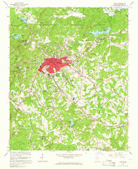
1964 Map of Toccoa
USGS Topo · Published 1966About this map
The city of Toccoa serves as the industrial and cultural anchor of this mid-1960s survey, situated along the Southern railroad line. The landscape is characterized by a mix of educational and religious institutions, including the Toccoa Falls Institute near the famous Toccoa Falls and the Whitman Street High Sch in the urban center. North of the city, the Chattahoochee National Forest boundary encloses the Toccoa Reservoir and several small lakes, while the Hartwell Reservoir begins its reach to the northeast.
Find a feature on this map
109 named features on this map. Tap any name to fly to it.
Don’t see what you’re looking for? This feature index may not catch every label — zoom into the map to look around manually.
Map Details
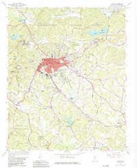
Editions of this 1964 Toccoa Map
2 editions found
Other maps of this area

1886 · Walhalla
USGS Topo · 1:125,000

1891 · Carnesville
USGS Topo · 1:125,000

1892 · Walhalla
USGS Topo · 1:125,000

1896 · Walhalla
USGS Topo · 1:125,000

1953 · Tallulah Falls
USGS Topo · 1:24,000

1954 · Greenville
USGS Topo · 1:250,000

1957 · Tugaloo Lake
USGS Topo · 1:24,000

1958 · Greenville
USGS Topo · 1:250,000

1960 · Martin
USGS Topo · 1:24,000
1963 · Holly Springs
USGS Topo · 1:24,000