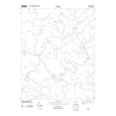
2010 Map of Todd
USGS Topo · Published 2010About this map
The South Fork New River snakes through this mountain landscape, its path mirrored by the winding Todd Railroad Grade Rd, reflecting a geography shaped by both water and rail history. This map highlights the rural communities of Todd, Fleetwood, and Brownwood at a time when the legacy of local transport and commerce remained etched in the road names and small settlements. The river valley is flanked by high ridges and peaks such as Bald Mountain and Mulatto Mountain, while smaller drainage systems like Cranberry Creek and Old Fields Creek carve out hollows that have historically supported scattered farmsteads and homesites. Significant landmarks include the Fleetwood Falls Dam and several community hubs identified by road names, such as Zion Methodist Church Rd, pointing to the enduring social anchors of the county.
Find a feature on this map
106 named features on this map. Tap any name to fly to it.
Don’t see what you’re looking for? This feature index may not catch every label — zoom into the map to look around manually.
Map Details
Editions of this 2010 Todd Map
This is the sole edition of this map. No revisions or reprints were ever made.
Other maps of this area

1889 · Wilkesboro
USGS Topo · 1:125,000

1891 · Wilkesboro
USGS Topo · 1:125,000

1893 · Cranberry
USGS Topo · 1:125,000

1895 · Cranberry
USGS Topo · 1:125,000

1899 · Cranberry
USGS Topo · 1:125,000

1902 · Cranberry
USGS Topo · 1:125,000

1934 · Boone
USGS Topo · 1:24,000

1935 · Baldwin Gap
USGS Topo · 1:24,000

1935 · Zionville
USGS Topo · 1:24,000

1936 · Blowing Rock
USGS Topo · 1:48,000