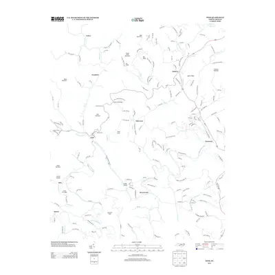
2013 Map of Todd
USGS Topo · Published 2013About this map
The S Fork New River winds through this section of the Blue Ridge, anchoring a landscape of scattered rural communities and high mountain terrain. The settlement of Todd sits near the river's bend, while other local centers such as Fleetwood, Baldwin, and Brownwood are linked by a network of named mountain roads and creek valleys. Topographically, the area is defined by significant elevations including Bald Mountain, Rich Mountain, and Mulatto Mountain, which create a complex system of ridges and gaps like Laurel Knob Gap. Local history is reflected in several family-named landmarks and smaller hamlets such as Toliver, Woodford, and Moretz. The map also details numerous watercourses that feed the larger river system, including Elk Cr, Cranberry Cr, and Grassy Cr, which features the named Grassy Island.
Find a feature on this map
169 named features on this map. Tap any name to fly to it.
Don’t see what you’re looking for? This feature index may not catch every label — zoom into the map to look around manually.
Map Details
Editions of this 2013 Todd Map
This is the sole edition of this map. No revisions or reprints were ever made.
Other maps of this area

1889 · Wilkesboro
USGS Topo · 1:125,000

1891 · Wilkesboro
USGS Topo · 1:125,000

1893 · Cranberry
USGS Topo · 1:125,000

1895 · Cranberry
USGS Topo · 1:125,000

1899 · Cranberry
USGS Topo · 1:125,000

1902 · Cranberry
USGS Topo · 1:125,000

1934 · Boone
USGS Topo · 1:24,000

1935 · Baldwin Gap
USGS Topo · 1:24,000

1935 · Zionville
USGS Topo · 1:24,000

1936 · Blowing Rock
USGS Topo · 1:48,000