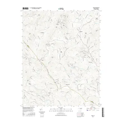
2016 Map of Todd
USGS Topo · Published 2016About this map
The South Fork New River carves a winding path through the high-elevation terrain of the Blue Ridge, serving as a defining corridor for the communities of Todd and Fleetwood. By 2016, this landscape at the border of Ashe Co and Watauga Co shows a complex network of mountain roads and ridges, including Bee Ridge and Elk Ridge. Small settlements like Toliver, Woodford, and Brownwood are distributed along the narrow valley floors and lower slopes, reflecting a traditional Appalachian settlement pattern adapted to the steep geography of Bald Mtn and Laurel Knob Mtn. Local landmarks such as Grassy Island and Fleetwood Falls Lake provide specific points of reference for those tracing family property or regional development near the southern edge of West Jefferson. The map documents the persistent rural character of these river communities even as modern residential developments and forest service roads expand into the higher elevations.
Find a feature on this map
181 named features on this map. Tap any name to fly to it.
Don’t see what you’re looking for? This feature index may not catch every label — zoom into the map to look around manually.
Map Details
Editions of this 2016 Todd Map
This is the sole edition of this map. No revisions or reprints were ever made.
Other maps of this area

1889 · Wilkesboro
USGS Topo · 1:125,000

1891 · Wilkesboro
USGS Topo · 1:125,000

1893 · Cranberry
USGS Topo · 1:125,000

1895 · Cranberry
USGS Topo · 1:125,000

1899 · Cranberry
USGS Topo · 1:125,000

1902 · Cranberry
USGS Topo · 1:125,000

1934 · Boone
USGS Topo · 1:24,000

1935 · Baldwin Gap
USGS Topo · 1:24,000

1935 · Zionville
USGS Topo · 1:24,000

1936 · Blowing Rock
USGS Topo · 1:48,000