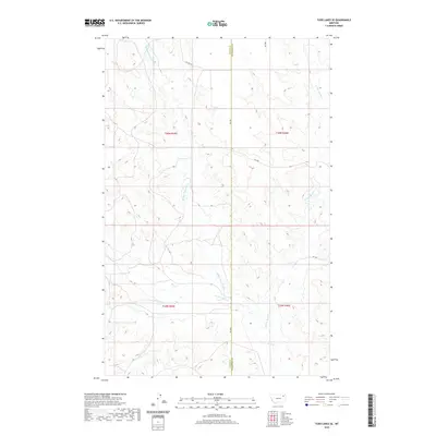
2020 Map of Todd Lakes SE
USGS Topo · Published 2020About this map
Wolf Cr and its numerous tributaries dominate this high plains landscape along the border of Valley and Roosevelt counties. The intricate drainage network includes the Middle Fork Wolf Cr, W Fork Wolf Cr, and E Fork Wolf Cr, which carve a complex series of coulees and draws through the Missouri River breaks region. This 2020 survey illustrates a primarily pastoral and agricultural environment, where the land is divided into the large sections of T30N and T29N. Modern infrastructure is limited to a grid of rural routes such as Rd 1081 and Co Line Rd, reflecting the sparse settlement patterns of the northern Montana prairie. The confluence of Dry Fork Wolf Cr with the main branches provides a clear view of the natural hydrology that has dictated land use and travel in the Wolf Point district for generations.
Find a feature on this map
16 named features on this map. Tap any name to fly to it.
Don’t see what you’re looking for? This feature index may not catch every label — zoom into the map to look around manually.
Map Details
Editions of this 2020 Todd Lakes SE Map
This is the sole edition of this map. No revisions or reprints were ever made.
Other maps of this area

1910 · Todd Lakes
USGS Topo · 1:62,500

1915 · Tule Valley
USGS Topo · 1:62,500

1915 · Oswego
USGS Topo · 1:62,500

1915 · Todd Lakes
USGS Topo · 1:62,500

1916 · Wolf Point
USGS Topo · 1:62,500

1954 · Wolf Point
USGS Topo · 1:250,000

1958 · Wolf Point
USGS Topo · 1:250,000

1972 · Flynn Creek North
USGS Topo · 1:24,000
1972 · Oswego NW
USGS Topo · 1:24,000
1972 · Wolf Point NW
USGS Topo · 1:24,000