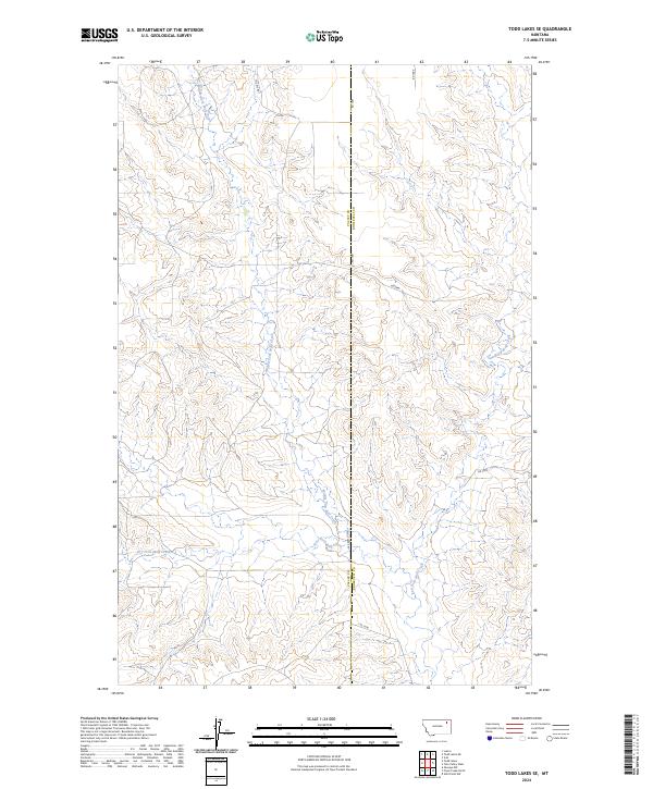
2024 Map of Todd Lakes SE
USGS Topo · Published 2024About this map
The Valley Co Roosevelt Co boundary line bisects this landscape, marking the transition between two distinct Montana jurisdictions. The terrain is defined by an intricate network of drainage systems, most notably the confluence of several branches of Wolf Creek. The Middle Fork Wolf Creek travels north to south, joined by the West Fork Wolf Creek and Dry Fork Wolf Creek in the southwest quadrant, while the East Fork Wolf Creek carves through the eastern sections.
Find a feature on this map
16 named features on this map. Tap any name to fly to it.
Don’t see what you’re looking for? This feature index may not catch every label — zoom into the map to look around manually.
Map Details
Editions of this 2024 Todd Lakes SE Map
This is the sole edition of this map. No revisions or reprints were ever made.
Other maps of this area

1910 · Todd Lakes
USGS Topo · 1:62,500

1915 · Tule Valley
USGS Topo · 1:62,500

1915 · Oswego
USGS Topo · 1:62,500

1915 · Todd Lakes
USGS Topo · 1:62,500

1916 · Wolf Point
USGS Topo · 1:62,500

1954 · Wolf Point
USGS Topo · 1:250,000

1958 · Wolf Point
USGS Topo · 1:250,000

1972 · Flynn Creek North
USGS Topo · 1:24,000
1972 · Oswego NW
USGS Topo · 1:24,000
1972 · Wolf Point NW
USGS Topo · 1:24,000