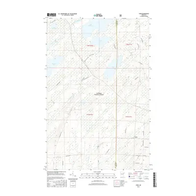
2016 Map of Toimi
USGS Topo · Published 2016About this map
Superior National Forest encompasses the majority of this landscape in northeastern Minnesota, where the drainage of the Saint Louis River and Whiteface River Br meet a complex network of glacial lakes. The settlement of Toimi serves as a small rural hub in the southeast, situated near the intersection of several named local routes including Toimi Road and Murphy Lake Road. To the west, the Bassett Cem provides a specific point of interest for genealogists researching the area's early residents.
Find a feature on this map
35 named features on this map. Tap any name to fly to it.
Don’t see what you’re looking for? This feature index may not catch every label — zoom into the map to look around manually.
Map Details
Editions of this 2016 Toimi Map
This is the sole edition of this map. No revisions or reprints were ever made.
Other maps of this area
1951 · Babbitt SW
USGS Topo · 1:24,000
1952 · Babbitt SE
USGS Topo · 1:24,000
1953 · Whyte
USGS Topo · 1:62,500
1954 · Greenwood Lake
USGS Topo · 1:62,500
1954 · Two Harbors
USGS Topo · 1:250,000
1957 · Two Harbors
USGS Topo · 1:250,000
1957 · Brimson
USGS Topo · 1:62,500
1958 · Two Harbors
USGS Topo · 1:250,000
1964 · Two Harbors
USGS Topo · 1:250,000
1976 · Brimson SW
USGS Topo · 1:24,000