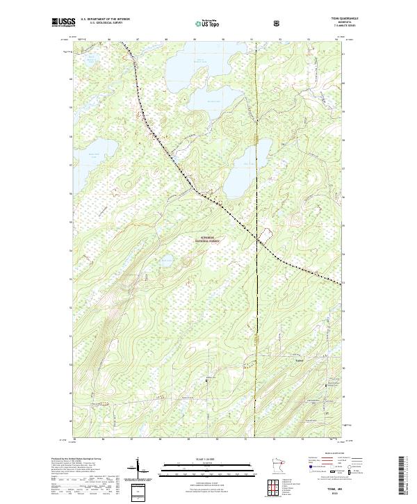
2022 Map of Toimi
USGS Topo · Published 2022About this map
Toimi stands at the intersection of rural life and the vast northern wilderness within the Superior National Forest. This landscape is defined by its complex hydrography, where the headwaters of the Saint Louis River and the N Br Whiteface River emerge from a network of significant water bodies including Seven Beaver Lake, Pine Lake, and Round Lake. The settlement patterns here are modest but deeply rooted, evidenced by family and community landmarks like the Toimi Childrens Settlers Cem and Bassett Cem.
Find a feature on this map
39 named features on this map. Tap any name to fly to it.
Don’t see what you’re looking for? This feature index may not catch every label — zoom into the map to look around manually.
Map Details
Editions of this 2022 Toimi Map
This is the sole edition of this map. No revisions or reprints were ever made.
Other maps of this area

1951 · Babbitt SW
USGS Topo · 1:24,000

1952 · Babbitt SE
USGS Topo · 1:24,000

1953 · Whyte
USGS Topo · 1:62,500

1954 · Greenwood Lake
USGS Topo · 1:62,500

1954 · Two Harbors
USGS Topo · 1:250,000

1957 · Two Harbors
USGS Topo · 1:250,000

1957 · Brimson
USGS Topo · 1:62,500

1958 · Two Harbors
USGS Topo · 1:250,000

1964 · Two Harbors
USGS Topo · 1:250,000
1976 · Brimson SW
USGS Topo · 1:24,000