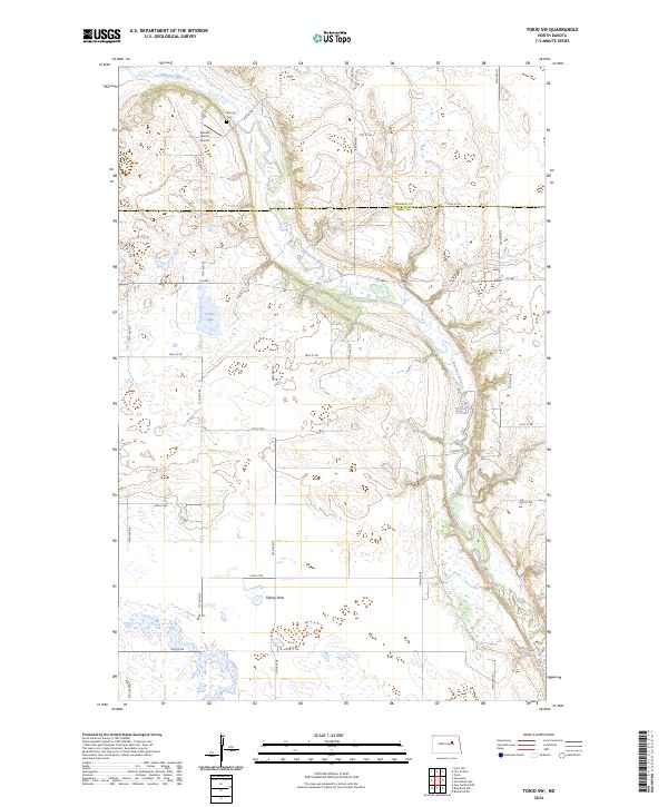
2024 Map of Tokio SW
USGS Topo · Published 2024About this map
The Sheyenne River cuts a deep, winding path through this portion of North Dakota, defining the boundary where Benson Co and Eddy Co meet. This landscape is characterized by its glacial hydrology, featuring the wide expanse of Tiffany Flats and the protected marshes of the Eddy County Waterfowl Production Area, which surrounds Goose Lake. Local history is centered on the Bourett family name, seen at both the Bourett Ranch Airport and the Bourett Cem tucked near a northern bend of the river. The map also documents the rural infrastructure of the early 21st century, showing the grid of section roads like 74th Ave NE and 31st St NE that navigate the pothole-studded prairie and connect isolated ranching operations.
Find a feature on this map
29 named features on this map. Tap any name to fly to it.
Don’t see what you’re looking for? This feature index may not catch every label — zoom into the map to look around manually.
Map Details
Editions of this 2024 Tokio SW Map
This is the sole edition of this map. No revisions or reprints were ever made.
Other maps of this area

1928 · Tokio
USGS Topo · 1:62,500

1931 · Oberon
USGS Topo · 1:62,500

1931 · Tokio
USGS Topo · 1:62,500

1944 · Brantford
USGS Topo · 1:62,500

1946 · Brantford
USGS Topo · 1:62,500

1948 · New Rockford
USGS Topo · 1:62,500

1950 · New Rockford NE
USGS Topo · 1:24,000

1950 · Brantford NW
USGS Topo · 1:24,000

1950 · Sheyenne
USGS Topo · 1:24,000

1950 · Brantford NE
USGS Topo · 1:24,000