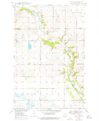
1975 Map of Tokio SW
USGS Topo · Published 1977About this map
The Sheyenne River winds through the heart of this Eddy County landscape, carving a valley between the elevated terrain of Hills and Tiffany. This 1975 photorevised survey highlights the agrarian and natural character of the region, featuring several family-named landmarks and essential rural infrastructure. Near the northern bend of the river, Bourett Dam and the nearby Bourett Cem sit within the Old Indian Reservation Bdy, indicating the historical significance of the land's previous boundaries. The map captures a quiet mid-century rural life where School No 1 served the surrounding farmsteads, and the Jackson Truck Trail provided access through the hills east of the river. Grounded in data from the 1940s with updates from the 1970s, the map also identifies localized industry like a Gravel Pit and several springs, including one simply labeled Spring near the central river bluffs.
Find a feature on this map
17 named features on this map. Tap any name to fly to it.
Don’t see what you’re looking for? This feature index may not catch every label — zoom into the map to look around manually.
Map Details
Editions of this 1975 Tokio SW Map
This is the sole edition of this map. No revisions or reprints were ever made.
Other maps of this area

1928 · Tokio
USGS Topo · 1:62,500

1931 · Oberon
USGS Topo · 1:62,500

1931 · Tokio
USGS Topo · 1:62,500

1944 · Brantford
USGS Topo · 1:62,500

1946 · Brantford
USGS Topo · 1:62,500

1948 · New Rockford
USGS Topo · 1:62,500

1950 · New Rockford NE
USGS Topo · 1:24,000

1950 · Brantford NW
USGS Topo · 1:24,000

1950 · Sheyenne
USGS Topo · 1:24,000

1950 · Brantford NE
USGS Topo · 1:24,000