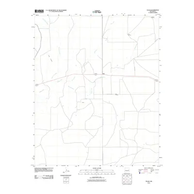
2010 Map of Tolar
USGS Topo · Published 2010About this map
The settlement of Tolar and the nearby community of Cooper anchor this high plains landscape in Roosevelt County during the early 21st century. The map illustrates a region defined by its ephemeral water sources and ranching infrastructure, where water is the primary driver of settlement. Notable features include Stinking Spring and a network of drainages such as Alamosa Creek, Taiban Creek, and Sand Creek. The agricultural and ranching heritage of the area is further evidenced by isolated landmarks like Lake Windmill and East Bell Windmill.
Find a feature on this map
14 named features on this map. Tap any name to fly to it.
Don’t see what you’re looking for? This feature index may not catch every label — zoom into the map to look around manually.
Map Details
Editions of this 2010 Tolar Map
This is the sole edition of this map. No revisions or reprints were ever made.
Other maps of this area

1954 · Fort Sumner
USGS Topo · 1:250,000

1954 · Clovis
USGS Topo · 1:250,000

1958 · Fort Sumner
USGS Topo · 1:250,000

1958 · Clovis
USGS Topo · 1:250,000

1968 · Lomas Gatos
USGS Topo · 1:24,000

1968 · Candy Mesa
USGS Topo · 1:24,000

1968 · Taiban
USGS Topo · 1:24,000

1973 · Tolar
USGS Topo · 1:24,000

1973 · Krider
USGS Topo · 1:24,000
1973 · Peach Canyon
USGS Topo · 1:24,000