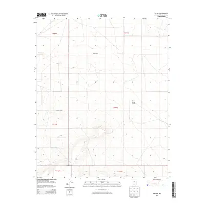
2013 Map of Tolar SE
USGS Topo · Published 2013About this map
The Mesa rises as a prominent landmark in this section of Roosevelt County, overlooking the drainage of Chapman Draw which snakes through the southern and northern corners of the map. This 2013 survey captures a landscape dominated by the Public Land Survey System, with the intersections of t2n r29e and adjacent townships defining the grid of rural transit. Remote agricultural infrastructure is evidenced by the West Jog Windmills, a vital water source in this high plains environment. The terrain is largely open, marked by a systematic network of county roads including N Roosevelt Road Ave and Roosevelt Road 6, which facilitate movement between these isolated ranching and farming tracts. This map provides a clear record of land division and the sparse but essential landmarks of the New Mexico plains at the start of the twenty-first century.
Find a feature on this map
14 named features on this map. Tap any name to fly to it.
Don’t see what you’re looking for? This feature index may not catch every label — zoom into the map to look around manually.
Map Details
Editions of this 2013 Tolar SE Map
This is the sole edition of this map. No revisions or reprints were ever made.
Other maps of this area

1954 · Clovis
USGS Topo · 1:250,000

1957 · Melrose
USGS Topo · 1:62,500

1958 · Clovis
USGS Topo · 1:250,000

1973 · Tolar
USGS Topo · 1:24,000

1973 · Krider
USGS Topo · 1:24,000

1973 · Melrose West
USGS Topo · 1:24,000

1973 · Tule Lake
USGS Topo · 1:24,000
1973 · Gammil Well
USGS Topo · 1:24,000

1973 · Gammil Well NE
USGS Topo · 1:24,000

1973 · Upton
USGS Topo · 1:24,000