
1973 Map of Gammil Well NE
USGS Topo · Published 1975About this map
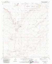
The Mesa dominates the northern landscape of this Roosevelt County quadrangle, where the sharp escarpments of the Melrose Range meet the high plains. This 1970s survey captures a transition in land use, showing the Military Reservation Boundary cutting across the northern sections of the map. Ranching infrastructure is well-established here, with family-named operations like the Price-Portales Ranch and Price West Camp serving as focal points for local history. The terrain is marked by distinct landmarks such as Negrohead Butte and the drainage of Cañada del Tule. For those looking for family roots, the Benson Cem is a notable genealogical landmark. Transportation is limited to a network of a Jeep Trail and a remote Landing Strip, illustrating the vast, low-density character of this New Mexico cattle country during the late twentieth century.
Find a feature on this map
14 named features on this map. Tap any name to fly to it.
Don’t see what you’re looking for? This feature index may not catch every label — zoom into the map to look around manually.
Map Details
Editions of this 1973 Gammil Well NE Map
2 editions found
Other maps of this area

1954 · Clovis
USGS Topo · 1:250,000

1957 · Melrose
USGS Topo · 1:62,500

1958 · Clovis
USGS Topo · 1:250,000

1973 · Lewiston Lake
USGS Topo · 1:24,000

1973 · Gammil Well SE
USGS Topo · 1:24,000

1973 · Tule Lake
USGS Topo · 1:24,000
1973 · Gammil Well
USGS Topo · 1:24,000

1973 · Upton
USGS Topo · 1:24,000
1973 · Rippee Ranch
USGS Topo · 1:24,000
1973 · Tolar SW
USGS Topo · 1:24,000