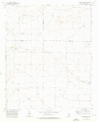
1973 Map of Rippee Ranch
USGS Topo · Published 1976About this map
White Draw and its South Fork White Draw carve through this high plains landscape at the intersection of Chaves, De Baca, and Roosevelt Counties. The area is defined by its remote ranching infrastructure, where water sources like Silas Tank and West Jett Windmill were essential for livestock and local habitation. The presence of Liston Cem near the center of the survey offers a poignant connection to the early families who settled this arid terrain.
Find a feature on this map
20 named features on this map. Tap any name to fly to it.
Don’t see what you’re looking for? This feature index may not catch every label — zoom into the map to look around manually.
Map Details
Editions of this 1973 Rippee Ranch Map
This is the sole edition of this map. No revisions or reprints were ever made.
Other maps of this area

1954 · Fort Sumner
USGS Topo · 1:250,000

1954 · Clovis
USGS Topo · 1:250,000

1954 · Brownfield
USGS Topo · 1:250,000

1955 · Roswell
USGS Topo · 1:250,000

1958 · Brownfield
USGS Topo · 1:250,000

1958 · Fort Sumner
USGS Topo · 1:250,000

1958 · Clovis
USGS Topo · 1:250,000

1958 · Roswell
USGS Topo · 1:250,000

1962 · Roswell
USGS Topo · 1:250,000

1962 · Brownfield
USGS Topo · 1:250,000