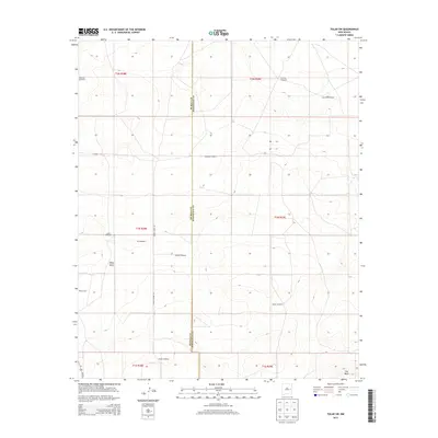
2013 Map of Tolar SW
USGS Topo · Published 2013About this map
Wind power and ranching infrastructure define the character of this high-plains landscape on the border of De Baca and Roosevelt counties. Numerous family-named landmarks are scattered throughout the region, including Noblitt Windmill, Lewis Windmill, and Diamond Windmill, highlighting the critical role of water sourcing in this arid environment. The terrain is marked by distinct geological formations such as White Mesa and The Mesa, which provide elevation changes in an otherwise consistent topography.
Find a feature on this map
22 named features on this map. Tap any name to fly to it.
Don’t see what you’re looking for? This feature index may not catch every label — zoom into the map to look around manually.
Map Details
Editions of this 2013 Tolar SW Map
This is the sole edition of this map. No revisions or reprints were ever made.
Other maps of this area

1954 · Fort Sumner
USGS Topo · 1:250,000

1954 · Clovis
USGS Topo · 1:250,000

1958 · Fort Sumner
USGS Topo · 1:250,000

1958 · Clovis
USGS Topo · 1:250,000
1967 · Watts Hill
USGS Topo · 1:24,000

1968 · Lomas Gatos
USGS Topo · 1:24,000

1968 · Taiban
USGS Topo · 1:24,000

1973 · Tolar
USGS Topo · 1:24,000

1973 · Krider
USGS Topo · 1:24,000
1973 · Gammil Well
USGS Topo · 1:24,000