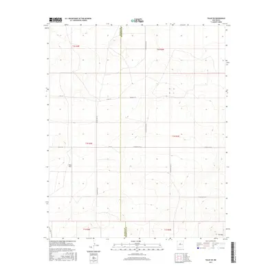
2017 Map of Tolar SW
USGS Topo · Published 2017About this map
White Mesa and the northern edge of The Mesa dominate this high-plains landscape along the boundary of De Baca and Roosevelt Counties. The terrain is defined by wide open spaces and a grid of rural routes that serve the ranching and agricultural interests of the region. Local thoroughfares like Wagon Wheel Rd, Roosevelt Rd 5, and Colt Rd connect the sectioned land parcels of the Llano Estacado. This 2017 survey reflects a modern era of land management, illustrating the persistent Public Land Survey System divisions that have structured this part of eastern New Mexico since the late 19th century. The sparse distribution of named features underscores the vast, open character of the country where water and high ground determine the placement of roads and homesteads.
Find a feature on this map
18 named features on this map. Tap any name to fly to it.
Don’t see what you’re looking for? This feature index may not catch every label — zoom into the map to look around manually.
Map Details
Editions of this 2017 Tolar SW Map
This is the sole edition of this map. No revisions or reprints were ever made.
Other maps of this area

1954 · Fort Sumner
USGS Topo · 1:250,000

1954 · Clovis
USGS Topo · 1:250,000

1958 · Fort Sumner
USGS Topo · 1:250,000

1958 · Clovis
USGS Topo · 1:250,000
1967 · Watts Hill
USGS Topo · 1:24,000

1968 · Lomas Gatos
USGS Topo · 1:24,000

1968 · Taiban
USGS Topo · 1:24,000

1973 · Tolar
USGS Topo · 1:24,000

1973 · Krider
USGS Topo · 1:24,000
1973 · Gammil Well
USGS Topo · 1:24,000