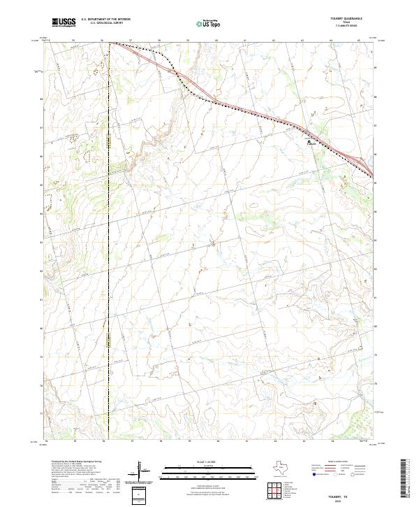
2022 Map of Tolbert
USGS Topo · Published 2022About this map
Tolbert serves as a central hub for this rural portion of the Red River Valley, situated just south of the Oklahoma border along the Hardeman and Wilbarger county line. The landscape is defined by the winding course of the Pease River in the south and a network of seasonal drainages, including Elizabeth Creek and Boggy Creek, that carve through the agricultural plains. For genealogists and local historians, the Tolbert Cemetery remains a significant landmark near the town site, reflecting the long-standing community ties in this ranching and farming region. The layout of rural roads, such as FM 925 and various county routes, follows a rigid grid that contrasts with the natural, meandering paths of the local creeks, illustrating the intersection of human surveying and the West Texas terrain.
Find a feature on this map
36 named features on this map. Tap any name to fly to it.
Don’t see what you’re looking for? This feature index may not catch every label — zoom into the map to look around manually.
Map Details
Editions of this 2022 Tolbert Map
This is the sole edition of this map. No revisions or reprints were ever made.
Other maps of this area

1955 · Lawton
USGS Topo · 1:250,000

1958 · Vernon
USGS Topo · 1:62,500

1958 · Medicine Mound
USGS Topo · 1:62,500

1958 · Elmer
USGS Topo · 1:62,500

1960 · Quanah
USGS Topo · 1:62,500

1983 · Warrior Hollow
USGS Topo · 1:24,000

1983 · Tolbert
USGS Topo · 1:24,000
1983 · Rayland
USGS Topo · 1:24,000
1983 · Lockett
USGS Topo · 1:24,000
1983 · Vernon
USGS Topo · 1:24,000