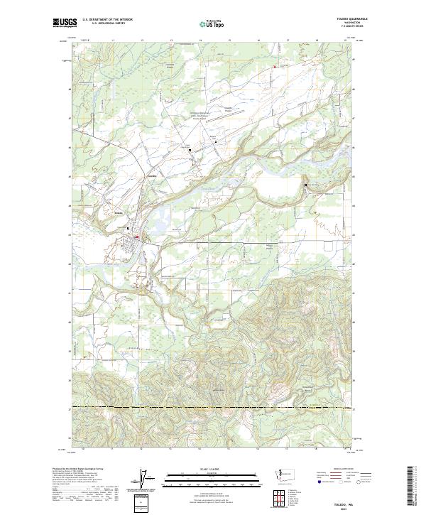
2023 Map of Toledo
USGS Topo · Published 2023About this map
Toledo sits at a strategic crossing of the Cowlitz River, serving as a focal point for the surrounding prairie lands in this 2023 survey. The landscape is defined by its distinct agrarian and alluvial zones, including Cowlitz Prairie, Lacamas Prairie, and Layton Prairie, which have historically supported the region's development. North of the river, the Ed Carlson Memorial Field - South Lewis County Airport occupies a prominent position on the prairie, while the settlement of Cowlitz marks the transition toward the river valley. The map is particularly useful for genealogical research, documenting several local burial grounds such as Toledo Cem, Saint Francis Cem, Lone Hill Cem, and Roberts Cem. To the south, the terrain becomes more varied as it rises into the Wilkes Hills and descends into Smokey Valley, with numerous drainage systems like Salmon Creek and Pin Creek shaping the topography near the Lewis Co Cowlitz Co border.
Find a feature on this map
93 named features on this map. Tap any name to fly to it.
Don’t see what you’re looking for? This feature index may not catch every label — zoom into the map to look around manually.
Map Details
Editions of this 2023 Toledo Map
This is the sole edition of this map. No revisions or reprints were ever made.
Other maps of this area

1916 · Chehalis
USGS Topo · 1:125,000

1941 · Olequa
USGS Topo · 1:62,500

1942 · Toutle
USGS Topo · 1:62,500

1943 · Willapa
USGS Topo · 1:62,500

1953 · Hoquiam
USGS Topo · 1:250,000

1953 · Toutle
USGS Topo · 1:62,500

1953 · Castle Rock
USGS Topo · 1:62,500

1954 · Onalaska
USGS Topo · 1:62,500

1954 · Centralia
USGS Topo · 1:62,500

1957 · Hoquiam
USGS Topo · 1:250,000