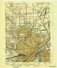
1938 Map of Toledo
USGS Topo · Published 1938About this map
The Maumee River serves as the industrial and logistical spine of this late 1930s landscape, where dense rail yards like the Airline Junction and Gloverleaf Yard underscore the city's role as a major transportation hub. The survey details a maturing urban environment, captured as neighborhoods like Mellwood and Ferndale expand northward toward the Michigan border. This era shows a community deeply invested in its civic and educational infrastructure, visible in the prominent footprints of Toledo University and several major secondary schools including DeVilbiss High Sch and Scott High Sch.
Find a feature on this map
119 named features on this map. Tap any name to fly to it.
Don’t see what you’re looking for? This feature index may not catch every label — zoom into the map to look around manually.
Map Details
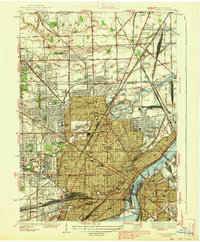
Editions of this 1938 Toledo Map
2 editions found
Other maps of this area

1900 · Maumee Bay
USGS Topo · 1:62,500

1900 · Toledo
USGS Topo · 1:62,500

1912 · Monroe
USGS Topo · 1:62,500

1912 · Dundee
USGS Topo · 1:62,500

1914 · Monroe
USGS Topo · 1:62,500

1926 · Dundee
USGS Topo · 1:62,500

1934 · Point Place
USGS Topo · 1:24,000

1934 · Rossford
USGS Topo · 1:24,000

1935 · Walbridge
USGS Topo · 1:24,000

1935 · Maumee
USGS Topo · 1:24,000