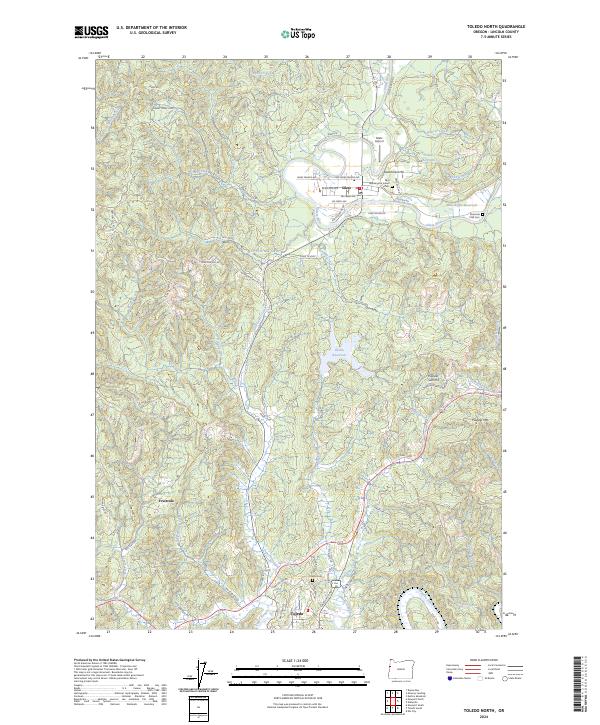
2024 Map of Toledo North
USGS Topo · Published 2024About this map
The Siletz River winds through the heart of this landscape, anchoring the community of Siletz and the tribal lands indicated by the Washington Indian Cem. To the south, the city of Toledo sits along the Depot Slough and the Yaquina River, showcasing the transition from riverfront industry to the surrounding upland ridges. The mapping of Siletz Reservoir and Olalla Reservoir highlights the managed water resources vital to this timber-rich region of the Oregon Coast Range. Smaller settlements such as Fruitvale and Riverside dot the periphery, connected by rural routes like Logsden Rd and Fruitvale Rd. Higher elevations are marked by Pioneer Mtn and Newton Hill, where the network of logging roads and loops—such as Camp 12 Loop and Dewey Creek Loop—reflects the area's deep-rooted connection to the Pacific Northwest forest economy.
Find a feature on this map
69 named features on this map. Tap any name to fly to it.
Don’t see what you’re looking for? This feature index may not catch every label — zoom into the map to look around manually.
Map Details
Editions of this 2024 Toledo North Map
This is the sole edition of this map. No revisions or reprints were ever made.
Other maps of this area

1941 · Cape Foulweather
USGS Topo · 1:62,500

1942 · Euchre Mtn
USGS Topo · 1:62,500

1942 · Yaquina
USGS Topo · 1:62,500

1942 · Toledo
USGS Topo · 1:62,500

1943 · Euchre Mtn
USGS Topo · 1:62,500

1944 · Cape Foulweather
USGS Topo · 1:62,500

1953 · Salem
USGS Topo · 1:250,000

1954 · Salem
USGS Topo · 1:250,000

1957 · Cape Foulweather
USGS Topo · 1:62,500

1957 · Yaquina
USGS Topo · 1:62,500