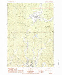
1984 Map of Toledo North
USGS Topo · Published 1984About this map
Toledo and Siletz anchor this 1984 survey of the central Oregon coast range, illustrating the deep ties between the timber industry and indigenous lands. The Siletz Indian Reservation occupies a significant portion of the landscape, where the Siletz River meanders near Government Hill and the Paul Washington Cem. To the south, the industrial character of the region is evident near the Yaquina River, with the Southern Pacific railroad serving the area.
Find a feature on this map
56 named features on this map. Tap any name to fly to it.
Don’t see what you’re looking for? This feature index may not catch every label — zoom into the map to look around manually.
Map Details
Editions of this 1984 Toledo North Map
This is the sole edition of this map. No revisions or reprints were ever made.
Other maps of this area

1941 · Cape Foulweather
USGS Topo · 1:62,500

1942 · Euchre Mtn
USGS Topo · 1:62,500

1942 · Yaquina
USGS Topo · 1:62,500

1942 · Toledo
USGS Topo · 1:62,500

1943 · Euchre Mtn
USGS Topo · 1:62,500

1944 · Cape Foulweather
USGS Topo · 1:62,500

1953 · Salem
USGS Topo · 1:250,000

1954 · Salem
USGS Topo · 1:250,000

1957 · Cape Foulweather
USGS Topo · 1:62,500

1957 · Yaquina
USGS Topo · 1:62,500