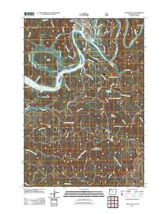
2011 Map of Toledo South
USGS Topo · Published 2011About this map
Toledo and its industrial riverfront dominate the northern landscape of this Lincoln County survey, where the Yaquina River winds through a complex system of sloughs and tidal marshes. The river serves as a central artery, flanked by the Toledo State Airport and the settlement of Butler Bridge. The mapping highlights the intricate drainage of the region, from Boone Slough and Johnson Slough in the west to the higher elevations of Strawberry Mountain and The Hogback in the east.
Find a feature on this map
64 named features on this map. Tap any name to fly to it.
Don’t see what you’re looking for? This feature index may not catch every label — zoom into the map to look around manually.
Map Details
Editions of this 2011 Toledo South Map
This is the sole edition of this map. No revisions or reprints were ever made.
Other maps of this area

1922 · Waldport
USGS Topo · 1:62,500

1942 · Waldport
USGS Topo · 1:62,500

1942 · Yaquina
USGS Topo · 1:62,500

1942 · Tidewater
USGS Topo · 1:62,500

1942 · Toledo
USGS Topo · 1:62,500

1953 · Salem
USGS Topo · 1:250,000

1954 · Salem
USGS Topo · 1:250,000

1956 · Tidewater
USGS Topo · 1:62,500

1956 · Waldport
USGS Topo · 1:62,500

1957 · Yaquina
USGS Topo · 1:62,500