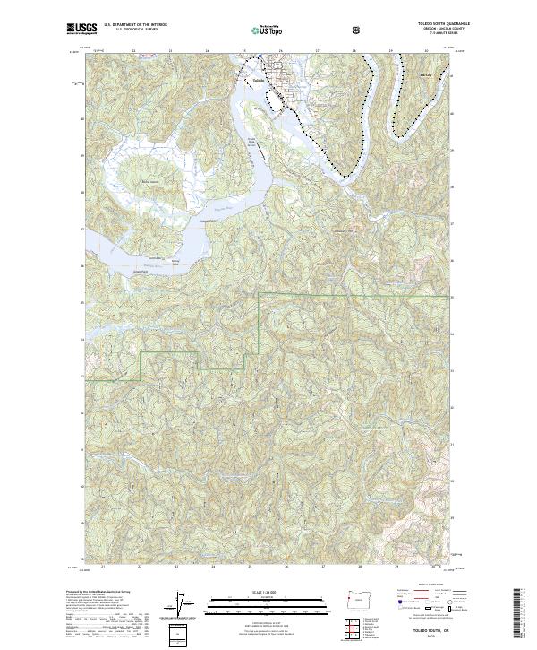
2023 Map of Toledo South
USGS Topo · Published 2023About this map
Toledo and the riverfront communities of Lincoln County are defined by a complex network of sloughs and tidal channels where the Yaquina River meets the coastal hills. This 2023 survey details the industrial and maritime layout of the region, from the Toledo State Airport to the rail and road connections at Elk City. The landscape is a transition between the managed waters of Olalla Barrier Reservoir and the wilder, higher elevations of Strawberry Mtn and the Mill Creek Divide.
Find a feature on this map
61 named features on this map. Tap any name to fly to it.
Don’t see what you’re looking for? This feature index may not catch every label — zoom into the map to look around manually.
Map Details
Editions of this 2023 Toledo South Map
This is the sole edition of this map. No revisions or reprints were ever made.
Other maps of this area

1922 · Waldport
USGS Topo · 1:62,500

1942 · Waldport
USGS Topo · 1:62,500

1942 · Yaquina
USGS Topo · 1:62,500

1942 · Tidewater
USGS Topo · 1:62,500

1942 · Toledo
USGS Topo · 1:62,500

1953 · Salem
USGS Topo · 1:250,000

1954 · Salem
USGS Topo · 1:250,000

1956 · Tidewater
USGS Topo · 1:62,500

1956 · Waldport
USGS Topo · 1:62,500

1957 · Yaquina
USGS Topo · 1:62,500