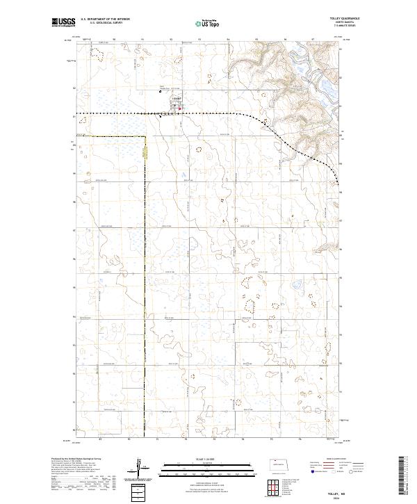
2024 Map of Tolley
USGS Topo · Published 2024About this map
The settlement of Tolley serves as the central hub for this portion of the northern plains, characterized by a strictly organized grid of agricultural section lines and rural roadways. The landscape is defined by the sweeping course of the Souris River as it enters the Upper Souris National Wildlife Refuge in the northeastern corner, where the terrain breaks from the surrounding flatlands into more complex coulees and wetlands. Local history and genealogy are anchored by the presence of Saint Charles Cem and Trinity Cem, both located in close proximity to the town site. The map details the local infrastructure connecting these remote prairie communities, including Co Hwy 2 and a dense network of county roads like Co Rd 3, illustrating the persistent layout of Renville County's farming heartland.
Find a feature on this map
37 named features on this map. Tap any name to fly to it.
Don’t see what you’re looking for? This feature index may not catch every label — zoom into the map to look around manually.
Map Details
Editions of this 2024 Tolley Map
This is the sole edition of this map. No revisions or reprints were ever made.
Other maps of this area

1947 · Tolley
USGS Topo · 1:62,500

1948 · Norma
USGS Topo · 1:24,000

1948 · Tolley
USGS Topo · 1:24,000

1948 · Donnybrook
USGS Topo · 1:24,000

1949 · Tolley SE
USGS Topo · 1:24,000

1949 · Mohall SW
USGS Topo · 1:24,000

1949 · Grano SW
USGS Topo · 1:24,000

1949 · Greene
USGS Topo · 1:24,000

1949 · Mouse River Park SW
USGS Topo · 1:24,000

1949 · Mouse River Park
USGS Topo · 1:24,000