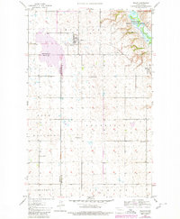
1980 Map of Tolley
USGS Topo · Published 1980About this map
Tolley serves as the central hub of this prairie landscape, where the Soo Line railroad bisects the town near the Trinity Cem. The terrain is defined by its vast agricultural townships including Sauk Prairie, Roosevelt, and Greenbush. To the northeast, the Souris River meanders through the Upper Souris National Wildlife Refuge, marking a sharp contrast between the riparian corridor and the surrounding upland farms.
Find a feature on this map
16 named features on this map. Tap any name to fly to it.
Don’t see what you’re looking for? This feature index may not catch every label — zoom into the map to look around manually.
Map Details
Editions of this 1980 Tolley Map
This is the sole edition of this map. No revisions or reprints were ever made.
Other maps of this area

1947 · Tolley
USGS Topo · 1:62,500

1948 · Norma
USGS Topo · 1:24,000

1948 · Tolley
USGS Topo · 1:24,000

1948 · Donnybrook
USGS Topo · 1:24,000

1949 · Tolley SE
USGS Topo · 1:24,000

1949 · Mohall SW
USGS Topo · 1:24,000

1949 · Grano SW
USGS Topo · 1:24,000

1949 · Greene
USGS Topo · 1:24,000

1949 · Mouse River Park SW
USGS Topo · 1:24,000

1949 · Mouse River Park
USGS Topo · 1:24,000