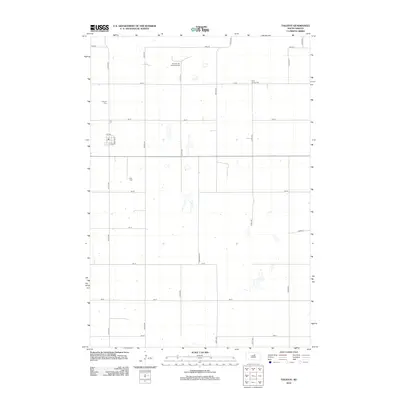
2012 Map of Tolstoy
USGS Topo · Published 2012About this map
Potter County’s agricultural landscape is defined by a rigid section-line road grid in this 2012 survey of the Tolstoy area. The town itself is compactly situated at the junction of 1st Ave and Dufloth St, providing a clear view of the community's mid-20th-century residential footprint and small-town street plan. This map is particularly valuable for genealogists, as it identifies several denominational burial grounds scattered across the prairie, including the Seventh-Day Adventist Cem to the north and the Lutheran Cem to the west. Farther east, the Saint Jacobs Cem and Zion Cem further document the religious and ethnic settlement patterns of this South Dakota region. The terrain is marked by intermittent water bodies and a sparse road network extending along names like Sherman Ave and various numbered streets, illustrating the vast open spaces characteristic of the Great Plains.
Find a feature on this map
24 named features on this map. Tap any name to fly to it.
Don’t see what you’re looking for? This feature index may not catch every label — zoom into the map to look around manually.
Map Details
Editions of this 2012 Tolstoy Map
This is the sole edition of this map. No revisions or reprints were ever made.
Other maps of this area

1950 · Onaka
USGS Topo · 1:24,000

1952 · Onaka
USGS Topo · 1:24,000

1952 · Onaka SW
USGS Topo · 1:24,000

1954 · Aberdeen
USGS Topo · 1:250,000

1956 · Aberdeen
USGS Topo · 1:250,000

1965 · Onaka
USGS Topo · 1:24,000

1974 · Bowdle SE
USGS Topo · 1:24,000

1974 · Roscoe SW
USGS Topo · 1:24,000
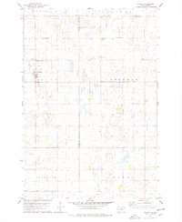
1978 · Tolstoy
USGS Topo · 1:24,000

1978 · Seneca NW
USGS Topo · 1:24,000