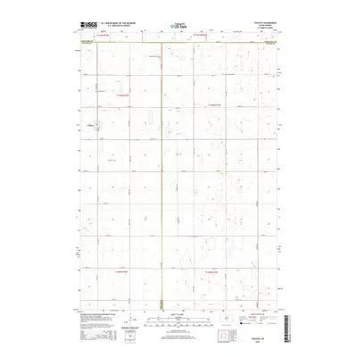
2015 Map of Tolstoy
USGS Topo · Published 2015About this map
Tolstoy serves as the primary community in this prairie landscape, situated near the intersection of 327th Ave and CR-954. The surrounding terrain is defined by a grid of section lines and numerous small depressions, characteristic of the region’s glacial topography. This 2015 survey reveals a strong thread of local heritage through its many burial grounds, including the Saint Jacobs Cem and Lutheran Cem. These sites, along with the Seventh-Day Adventist Cem and Zion Cem, are essential markers for genealogists and local historians tracking early families across the borders of Potter, Edmunds, and Faulk counties. The map provides a precise layout of rural life where the prairie meets the developed grid of named roads like Sherman Ave and 148th St.
Find a feature on this map
31 named features on this map. Tap any name to fly to it.
Don’t see what you’re looking for? This feature index may not catch every label — zoom into the map to look around manually.
Map Details
Editions of this 2015 Tolstoy Map
This is the sole edition of this map. No revisions or reprints were ever made.
Other maps of this area

1950 · Onaka
USGS Topo · 1:24,000

1952 · Onaka
USGS Topo · 1:24,000

1952 · Onaka SW
USGS Topo · 1:24,000

1954 · Aberdeen
USGS Topo · 1:250,000

1956 · Aberdeen
USGS Topo · 1:250,000

1965 · Onaka
USGS Topo · 1:24,000

1974 · Bowdle SE
USGS Topo · 1:24,000

1974 · Roscoe SW
USGS Topo · 1:24,000
1978 · Tolstoy
USGS Topo · 1:24,000

1978 · Seneca NW
USGS Topo · 1:24,000