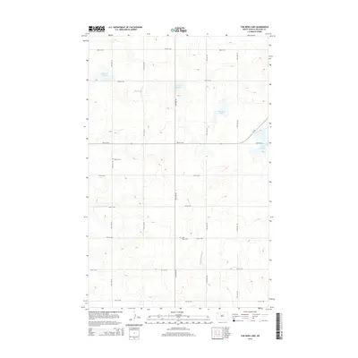
2014 Map of Tom Berg Lake
USGS Topo · Published 2014About this map
The Little Muddy River meanders through the heart of this Williams County landscape, an area defined by its complex hydrology of prairie sloughs and small lakes. Centered around Tom Berg Lake, the terrain features numerous natural depressions including Peterson Slough, Black Slough, and Berg Slough, which dominate the northern half of the quadrangle. This 2014 survey reveals a sparse but persistent rural network, where a grid of section-line roads like 83rd St NW and 118th Ave NW serves isolated homesteads and agricultural operations. Genealogy researchers will find significant landmarks at Bethel Cem in the northwest and Saint Pauls Cem further south, both situated near the Little Muddy River drainage. Modern infrastructure is represented primarily by ND-50, which cuts across the central-eastern portion of the sheet near Helle Slough.
Find a feature on this map
24 named features on this map. Tap any name to fly to it.
Don’t see what you’re looking for? This feature index may not catch every label — zoom into the map to look around manually.
Map Details
Editions of this 2014 Tom Berg Lake Map
This is the sole edition of this map. No revisions or reprints were ever made.
Other maps of this area

1911 · Ray
USGS Topo · 1:125,000

1948 · Alamo N.E.
USGS Topo · 1:24,000

1953 · Williston
USGS Topo · 1:250,000

1957 · Williston
USGS Topo · 1:250,000

1974 · Wildrose
USGS Topo · 1:24,000

1974 · Tom Berg Lake
USGS Topo · 1:24,000

1974 · Hamlet
USGS Topo · 1:24,000

1974 · Big Meadow
USGS Topo · 1:24,000

1978 · Corinth
USGS Topo · 1:24,000

1978 · Temple
USGS Topo · 1:24,000