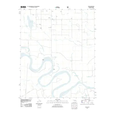
2010 Map of Tom
USGS Topo · Published 2010About this map
Red River oxbows and southern floodplains define this landscape along the Oklahoma-Texas border. The settlement of Tom serves as the local hub, surrounded by several smaller community burial sites including Harris Cemetery, Byrms Cemetery, Manning Cemetery, and Pine Ridge Cemetery, which provide valuable touchpoints for family history research. The river's winding path has created a complex network of backwater features, such as Severn Island and the Bailey Cut-off, alongside Numerous oxbow lakes like Ward Lake, Breedlove Lake, and Churchhouse Lake. The terrain rises slightly at Tom Lookout to the north, overlooking the low-lying wetlands of Hooks Bayou and Mill Creek that drain into the main river channel. This map documents the persistent agricultural and river-dependent layout of the region, where local transport depends on routes like Farm-To-Market Road 2735.
Find a feature on this map
27 named features on this map. Tap any name to fly to it.
Don’t see what you’re looking for? This feature index may not catch every label — zoom into the map to look around manually.
Map Details
Editions of this 2010 Tom Map
This is the sole edition of this map. No revisions or reprints were ever made.
Other maps of this area

1950 · De Kalb NW
USGS Topo · 1:24,000

1950 · Haworth
USGS Topo · 1:24,000

1950 · Tom
USGS Topo · 1:24,000

1950 · De Kalb
USGS Topo · 1:24,000

1950 · Oak Grove
USGS Topo · 1:24,000

1950 · Bokhoma
USGS Topo · 1:24,000

1951 · De Kalb
USGS Topo · 1:24,000

1951 · De Kalb NW
USGS Topo · 1:24,000

1951 · Haworth
USGS Topo · 1:24,000

1951 · Tom
USGS Topo · 1:24,000