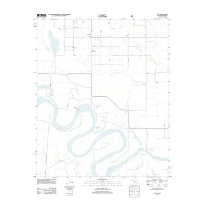
2012 Map of Tom
USGS Topo · Published 2012About this map
Tom anchors this region in McCurtain County, where the landscape is defined by the winding meanders of the Red River. The geography reveals a complex system of oxbow lakes and historical channel changes, visible in features like Bailey Cut-off, Snag Lake, and Caney Lake. These water bodies, along with Seven Island and Severn Island, reflect the shifting nature of the river border between Oklahoma and Texas.
Find a feature on this map
20 named features on this map. Tap any name to fly to it.
Don’t see what you’re looking for? This feature index may not catch every label — zoom into the map to look around manually.
Map Details
Editions of this 2012 Tom Map
This is the sole edition of this map. No revisions or reprints were ever made.
Other maps of this area

1950 · De Kalb NW
USGS Topo · 1:24,000

1950 · Haworth
USGS Topo · 1:24,000

1950 · Tom
USGS Topo · 1:24,000

1950 · De Kalb
USGS Topo · 1:24,000

1950 · Oak Grove
USGS Topo · 1:24,000

1950 · Bokhoma
USGS Topo · 1:24,000

1951 · De Kalb
USGS Topo · 1:24,000

1951 · De Kalb NW
USGS Topo · 1:24,000

1951 · Haworth
USGS Topo · 1:24,000

1951 · Tom
USGS Topo · 1:24,000