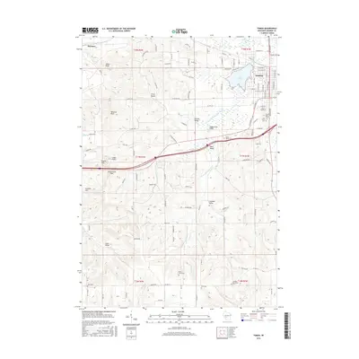
2016 Map of Tomah
USGS Topo · Published 2016About this map
The S Fork Lemonweir River and its numerous tributaries, including Council Cr and Chub Cr, define the drainage patterns of this Monroe County landscape. The city of Tomah is the central hub, situated near the shores of Lake Tomah and characterized by a dense grid of streets such as Superior Ave and McLean Ave. Surrounding the city, a series of named valleys and high points like Windrow Bluff, Pikes Peak, and Engine Rock reveal the complex topography of the region. Genealogists will find a high density of burial sites across the township, ranging from Oak Grove Cem and Saint Marys Cem in the north to Aney Cem and Worden Burroughs Cem in the southern sections, documenting the long-standing settlement of families in rural areas like Jacksonville Valley and Linnehan Valley.
Find a feature on this map
119 named features on this map. Tap any name to fly to it.
Don’t see what you’re looking for? This feature index may not catch every label — zoom into the map to look around manually.
Map Details
Editions of this 2016 Tomah Map
This is the sole edition of this map. No revisions or reprints were ever made.
Other maps of this area

1916 · Tomah
USGS Topo · 1:62,500

1919 · Kendall
USGS Topo · 1:62,500

1921 · Kendall
USGS Topo · 1:62,500

1947 · Millston
USGS Topo · 1:62,500

1949 · Millston
USGS Topo · 1:62,500

1949 · Tomah
USGS Topo · 1:62,500

1953 · Eau Claire
USGS Topo · 1:250,000

1958 · Eau Claire
USGS Topo · 1:250,000

1958 · Wyeville
USGS Topo · 1:48,000

1958 · La Crosse
USGS Topo · 1:250,000