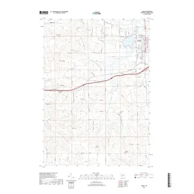
2018 Map of Tomah
USGS Topo · Published 2018About this map
Tomah serves as the primary hub of this Monroe County landscape, situated at the confluence of several key valleys and waterways. The S Fork Lemonweir River and Lake Tomah dominate the eastern sector, while the western terrain is defined by a series of distinct ridges and lowlands, including Stevens Valley, Reels Valley, and Linnehan Valley. This geography created natural corridors for movement, evidenced by the modern transit lines that follow the path of the Jacksonville Valley.
Find a feature on this map
124 named features on this map. Tap any name to fly to it.
Don’t see what you’re looking for? This feature index may not catch every label — zoom into the map to look around manually.
Map Details
Editions of this 2018 Tomah Map
This is the sole edition of this map. No revisions or reprints were ever made.
Other maps of this area

1916 · Tomah
USGS Topo · 1:62,500

1919 · Kendall
USGS Topo · 1:62,500

1921 · Kendall
USGS Topo · 1:62,500

1947 · Millston
USGS Topo · 1:62,500

1949 · Millston
USGS Topo · 1:62,500

1949 · Tomah
USGS Topo · 1:62,500

1953 · Eau Claire
USGS Topo · 1:250,000

1958 · Eau Claire
USGS Topo · 1:250,000

1958 · Wyeville
USGS Topo · 1:48,000

1958 · La Crosse
USGS Topo · 1:250,000